
Quarry Bay Orienteering Course
Maps
(Printing on A4 size paper is recommended for accurate scaling.)
Cross Country Courses
| Detail | Level | ||
|---|---|---|---|
| Beginner | Intermediate | Advanced | |
|
Length* (km) |
3.2 |
4.45 |
5.05 |
|
Climb (m) |
75 |
60 |
160 |
|
No. of Controls |
9 |
9 |
14 |
|
Map (click to download) |
|
|
|
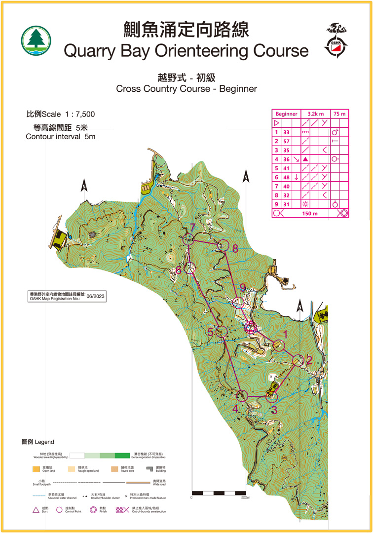
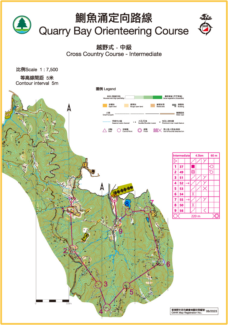
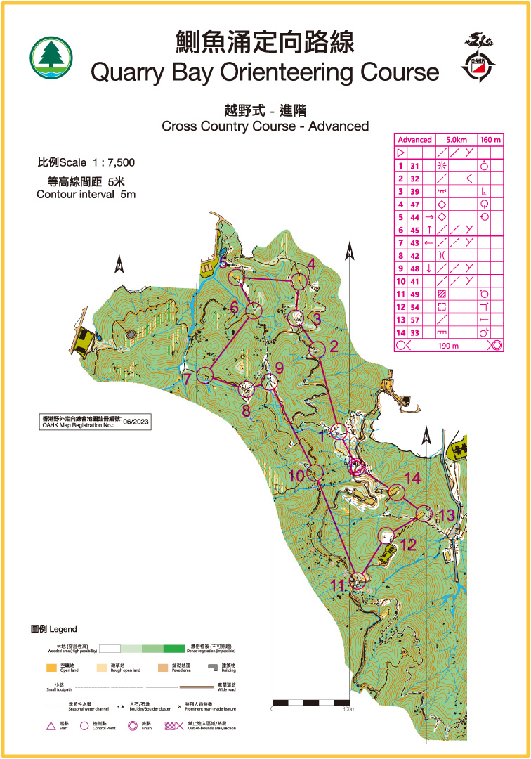
* Measured as straight line distance between controls.
Score Course / Master Map
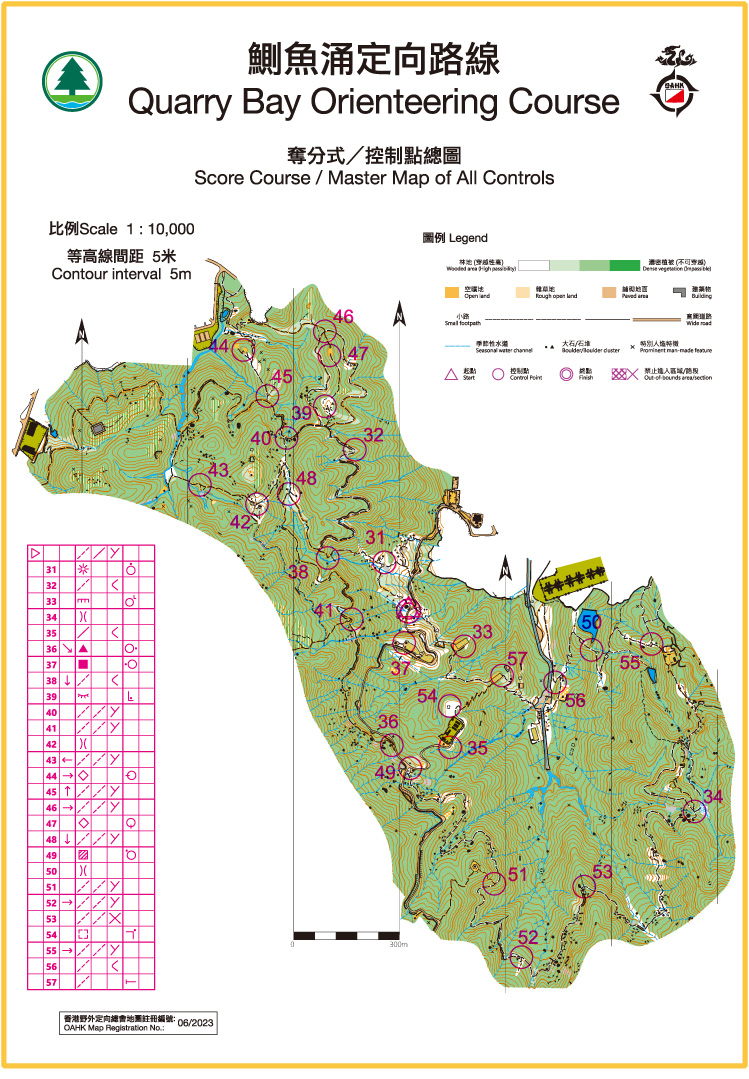
Total no. of controls: 27
Start
Mount Parker Road (opposite to entrance of Quarry Bay Tree Walk)
How to get there:
MTR
From Quarry Bay Station Exit A along King's Road eastward to Quarry Bay Municipal Services Building
Bus and Green Minibus Routes via King's Road, Quarry Bay
CityBus Route
77, 85, 99
NWFB Route
2, 2A, 18X, 81, 82, 82X, 722
Tunnel Bus Route
102, 106, 116, 606, 608, 613, 682, A12
Green Minibus Route
33, 69
For more information on orienteering, click here.