灣仔定向路線
路線地圖
(為保持準確地圖比例,建議A4尺寸紙張打印。)
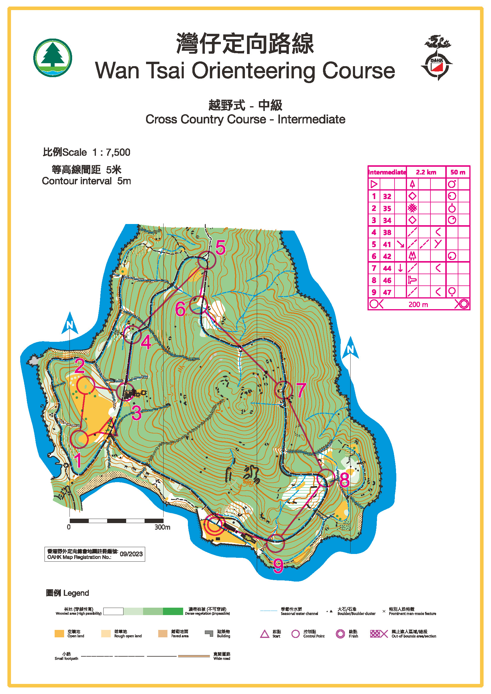
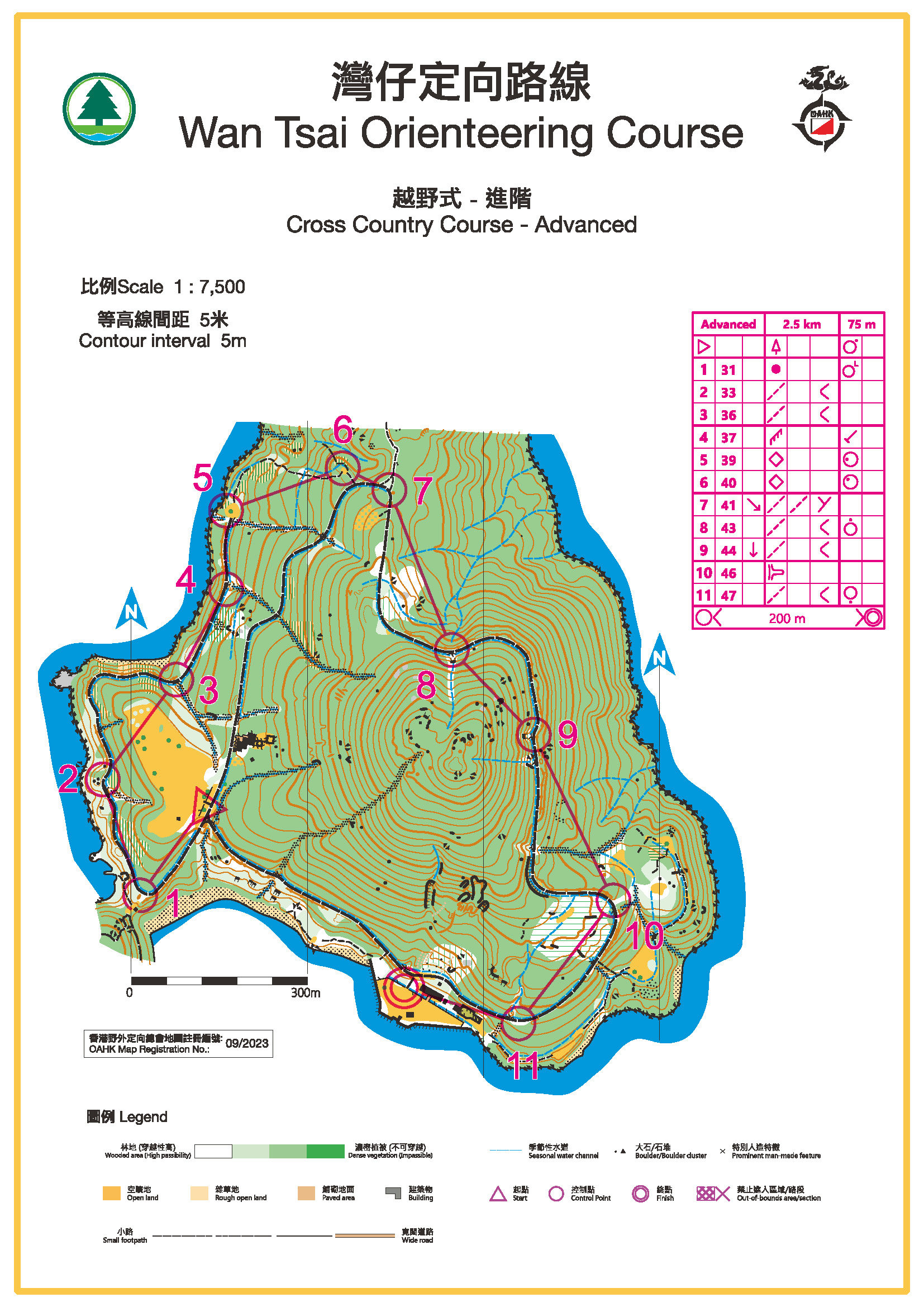
越野式路線
| 詳情 |
難度 |
| 初級 |
中級 |
進階 |
|
長度* (公里)
|
1.8
|
2.3
|
2.5
|
|
攀高 (米)
|
50
|
50
|
75
|
|
控制點數目
|
7
|
9
|
11
|
|
地圖
(按圖下載)
|

|
|
|
* 以控制點之間的直線距離量度
奪分式/控制點總圖
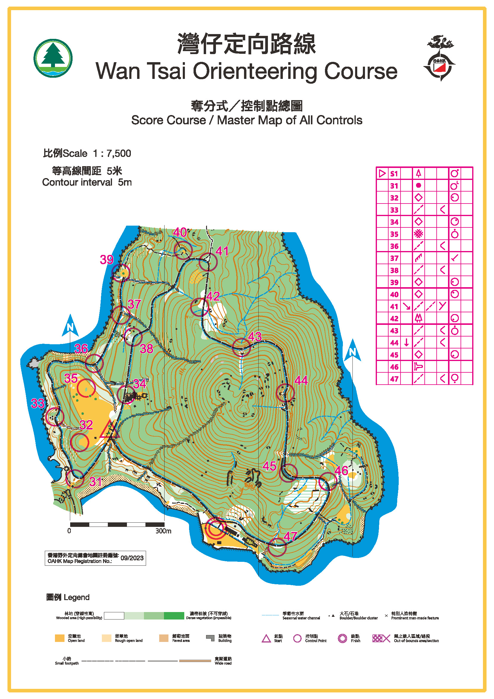
控制點總數:17
起點及終點位置
西貢灣仔西營地入口
前往起點及終點方法
由西貢市巴士總站乘7號往海下專線小巴,在海下村總站下車。由海下村步行前往,沿大灘郊遊徑,約需時45分鐘,便可抵達營地。
有關定向路線的簡介,請按此。