
Wan Tsai Orienteering Course
Maps
(Printing on A4 size paper is recommended for accurate scaling.)
Cross Country Courses
| Detail | Level | ||
|---|---|---|---|
| Beginner | Intermediate | Advanced | |
|
Length* (km) |
1.8 |
2.3 |
2.5 |
|
Climb (m) |
50 |
50 |
75 |
|
No. of Controls |
7 |
9 |
11 |
|
Map (click to download) |
|
|
|

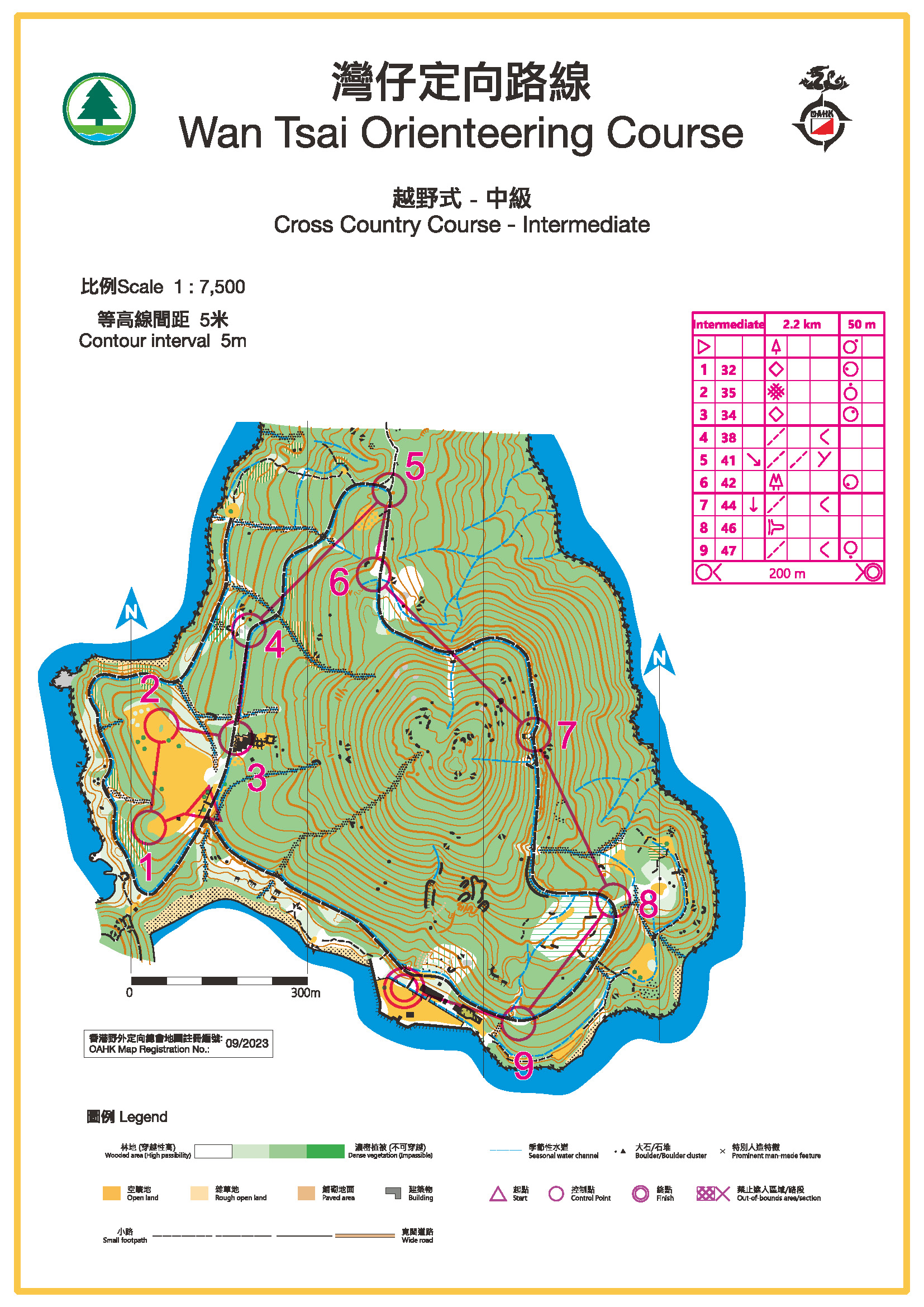
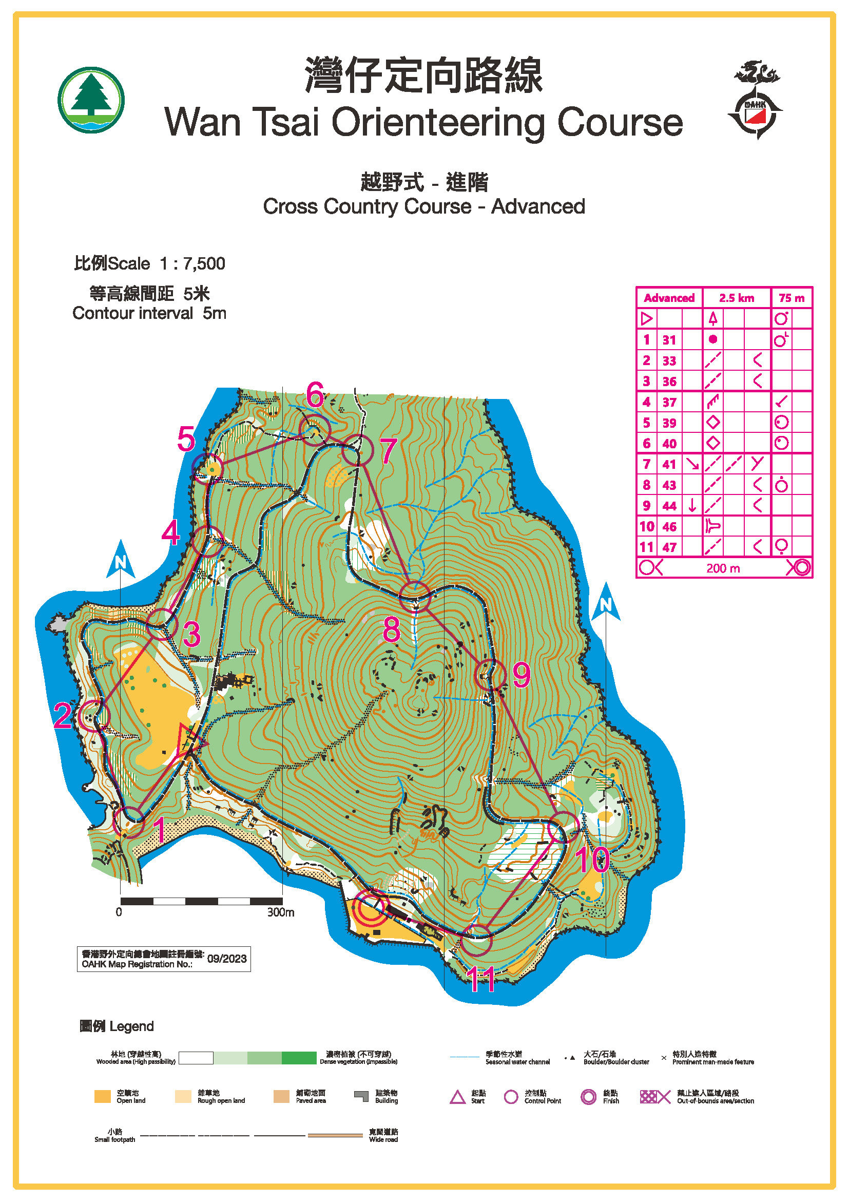
* Measured as straight line distance between controls.
Score Course / Master Map
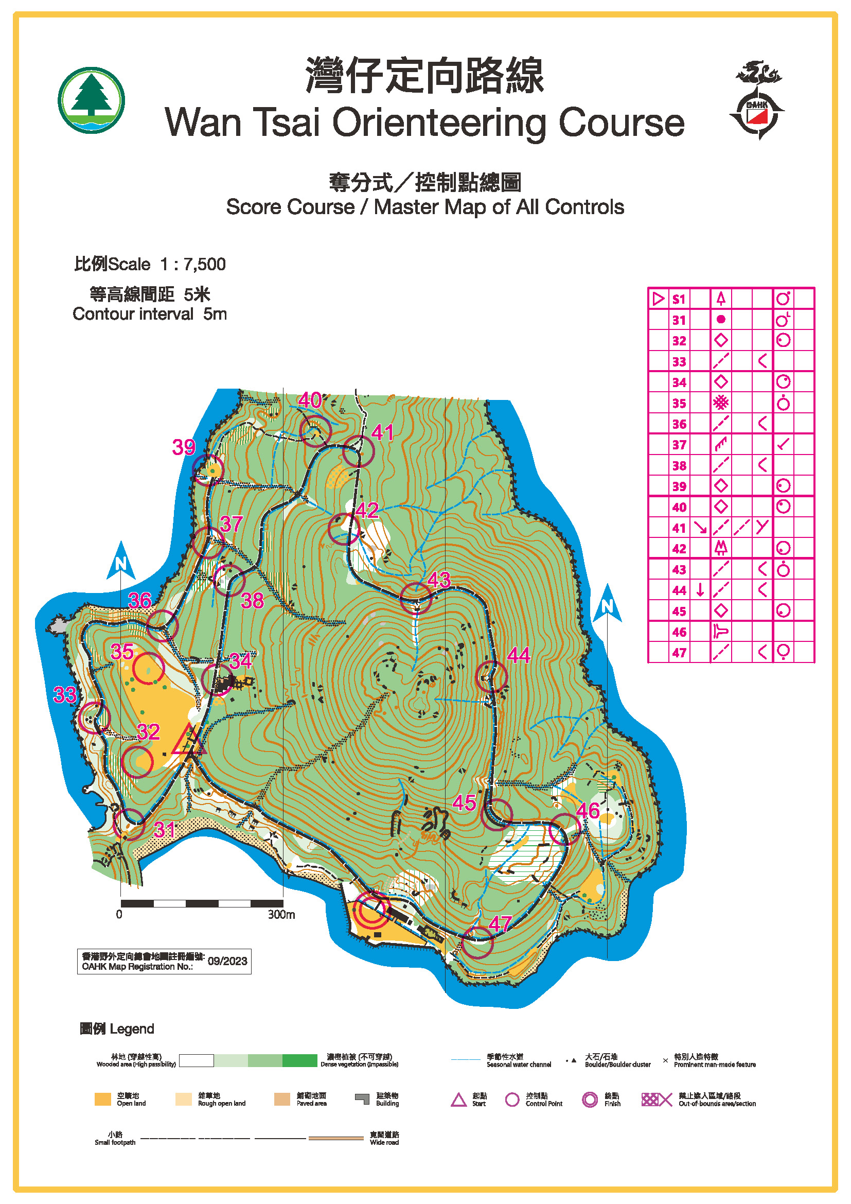
Total no. of controls: 17
Start
Entrance to Sai Kung Wan Tsai Campsite
How to get there:
From Sai Kung, take Minibus 7 and descend at Hoi Ha Village. Then, follow the Tai Tan Country Trail and walk for about 45 minutes.
For more information on orienteering, click here.